-40%
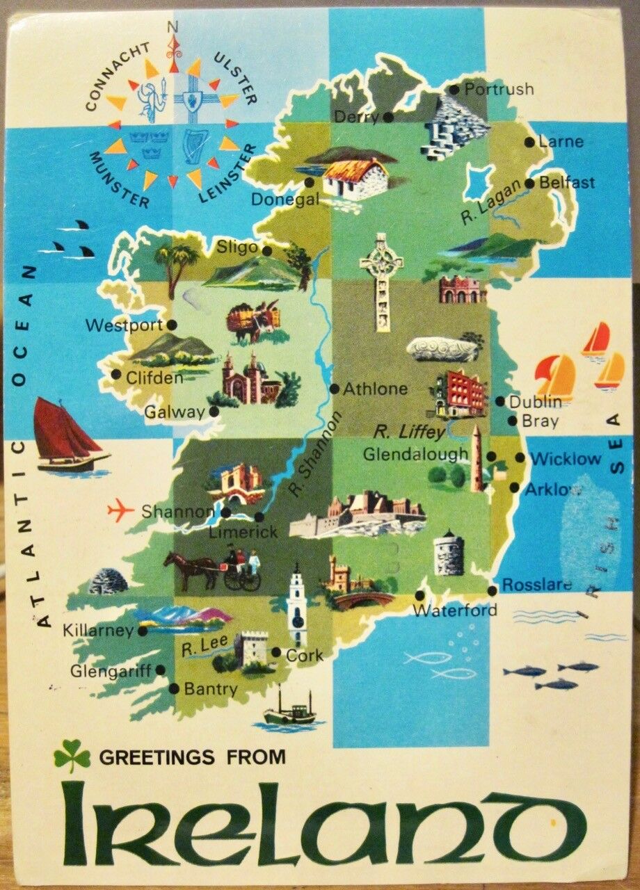
Irish Postcard Greetings From IRELAND Map with Cartoon Icons John Hinde 2/1 1981
$ 3.69
- Description
- Size Guide
Description
Continental-sized (approx. 4x6) chrome postcard with an illustrated map of Irelandincluding small cartoon illustrations / icons at famous sites, all on a blue-and-white
checkerboard background.
Front title reads, "Greetings From IRELAND".
Back caption reads, "IRELAND, an island, is the most westerly country in Europe
and covers an area of 32,524 sq. miles. Its greatest length is 302 miles and its greatest
width is 189 miles and no part is more than 70 miles from the sea. The country is divided
into four historic provinces. Ulster, Munster, Leinster and Connacht. Ireland's fascination
is legendary. The unique beauty of its landscape and its rich historic literary and artistic
associations have long made it a favourite resort for tourists."
Card No. 2/1 published by John Hinde Ltd., Cabinteely.
Split back; used, posted 198 to USA.
Inked note (blurry) reads:
"Dear Jo, Eileen, Casey, Barb and Marie,
We finally made it! Had to flly to London then fly to Shannon.
Many a story to tell about all of that. We are heading west & north
to Sligo and are spending this night in Galway. Driving here is
someting else. But, the Irish people are lovely & so willing to
help two poor blokes from the States. Much love, Rose."
Good condition with light foxing/age on address side and some edge and corner wear. See photos.
Ships securely in a protective plastic holder.
Free postage to all US addresses, and to Ireland and Northern Ireland. (Outside US: wait for an invoice or receive refund after purchase.)
We cheerfully combine postage for least cost to other destinations.
Sorry -- no tracking available on flat items under , which ship at letter rate.
Thanks so much for looking! See more vintage cards from Ireland at our eBay store, Montana Gael.
