-40%
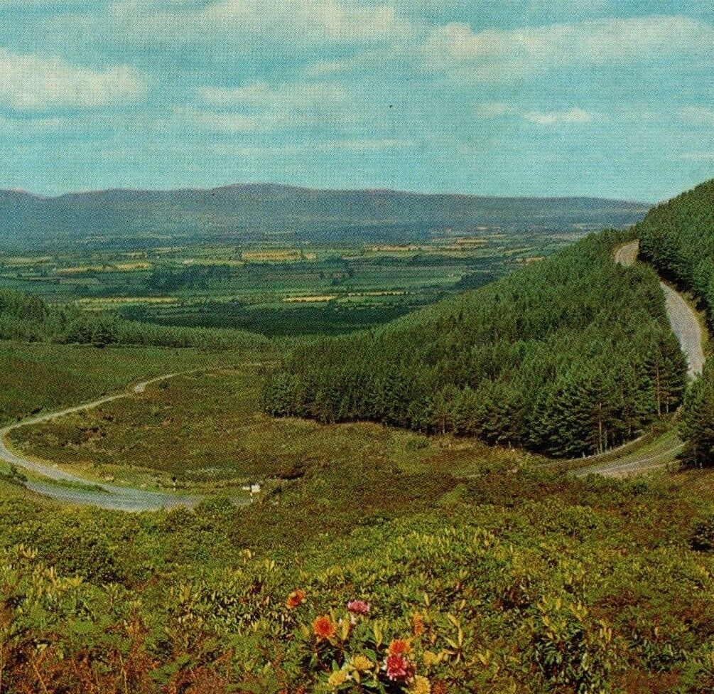
R668 Vee Road Knockmealdown Galtee Mountains Tipperary Ireland Vintage Postcard
$ 3.69
- Description
- Size Guide
Description
Front:The Vee Road, Knockmealdown and Galtee Mountains, Co. Tipperary, Ireland
Back:
The Vee Road, Knockmealdown, Co. Tipperary: The famous Vee Road winds its way through the Knockmealdown Mountains, Ireland's finest inland mountain range. Travelling from Lismore to Cahir or Clonmel, the Vee Road affords superb panoramas of mountain and plain. To the north can be seen the Galtee Mountains whose highest peak, Galtymore, is over 3,000 ft. high.
Published by Cardall Ltd., Dublin. Printed in the Republic of Ireland
385
Exact measurements:
15x10.6 centimeters = 5.91x4.17 inches.
Scroll down for more card background information.
~~~~~~~~~~~~~~~~~~~~~~~~~~~~~~~~~~~~~~~~~~~~~~~~~~~~~
PROCEDURE AND SHIPPING
Photos scanned at 600 dpi, zoom in to see detail. Actual item for sale is shown in photos. Colored edge around photos is my photo mat, not the card.
We understand that these are important parts of your collection, and we take extra steps to protect your purchase.
All postcards are placed in archival quality protective sleeves. The plastic protected postcards are then placed in a rigid photo mailer to prevent crushing. Finally, the rigid mailer is placed inside a padded bubble mailer.
We ship postcards via USPS First Class with tracking. This adds a layer of protection for us both. (
If you have issues with USPS in your area and need a different method, please let us know before paying.)
If you purchase multiple cards, we combine shipping so you only have one shipping charge. If you see a second shipping charge in your cart, please contact us before you pay so we can fix it.
The information on this listing is provided to the best of our ability. If you encounter errors, please let us know.
~~~~~~~~~~~~~~~~~~~~~~~~~~~~~~~~~~~~~~~~~~~~~~~~~~~~~
CARD BACKGROUND INFORMATION
The R668 road is a regional road in Ireland from Lismore, County Waterford to Cahir in County Tipperary, through Clogheen and Ballylooby. The Lismore–Clogheen section is a scenic route through the Vee Gap (Irish: Bóthar na gCorr) in the Knockmealdown Mountains, between Sugarloaf Hill and Knockshanahullion.
In the eighteenth century, the Cahir–Clogheen section was part of the main road from Cashel to Cork city. It was superseded in the early 19th century by the construction of what is now the R639 road between Cahir and Mitchelstown.
The R665 crosses the R668 at Clogheen. At Glentanagree Bridge, the R669 forks off to the south east past Mount Melleray to Cappoquin.
*Background information gathered from Wikipedia,
The Free Encyclopedia.
2/4


